My favorite places in the Maiella, Part 2
- Mike
- Jul 29, 2024
- 6 min read
Updated: Dec 12, 2024
See Part 1 also
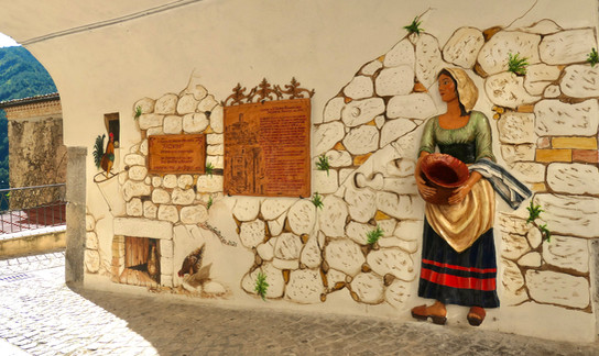
Caramanico Terme


Caramanico Terme is right in the middle of the Maiella and I was surprised to learn that full time residents here number only about 1,770 because it looks and feels like a much bigger community and has more hotels and restaurants than all the other Maiella towns. Caramanico is yet one more place inside the National Park that has lost population at every single census, resulting in a 50% drop since 1961.
However it has two important advantages for attracting summer tourists. The first is that, as the name suggests, it's a spa town and offers a wide range of therapeutic treatments in its thermal baths thanks to the high hydrogen sulphide content of the local mineral water.


Secondly it has one of the best locations, being the main gateway to many of the more interesting Maiella trails including some quite difficult ones that traverse the beautiful Orfento valley up to la Maielletta or go directly up to Monte Amaro, or via Decontra to the hermitages of San Bartolomeo and Santo Spirito. Caramanico Terme is also a popular mountain biking destination though the two trails I hiked would not have been possible on a bike.

Caramanico is not particularly high at only 2,000 feet and lies on the side of a hill on the main road that goes up to Passo San Leonardo descending to either Sulmona via Pacentro or Pescocostanzo via Campo di Giove. The main road goes through a tunnel under Caramanico so it doesn't detract from the small medieval part of town that stretches down the hillside.

There are several ancient churches in and around Caramanico including one named after Archbishop Thomas Becket who was murdered in Canterbury cathedral in 1170. It is a few miles outside town, closer in fact to Salle than Caramanico, and was founded in 45 A.D on the site of an old temple to Hercules. Today it is surrounded by the ruins of an ancient abbey.
Tocco da Casauria
Tocco da Casauria is on the north west boundary of the Maiella National Park just above the autostrada that runs along the valley floor.

It's an important olive oil center with olive groves for miles in every direction around the town and vines also seem to do well on these lower slopes of the Maiella. There is an excellent family winery based right in the middle of town that I visited called Guardiani Farchione; it produces a high quality range of Abruzzesi wines that we have written about separately.

Having lost one third of its population in the 1950s alone and many more since, the town itself is something of a disappointment visually and nor does the scenery compete with the other Maiella locations described here and elsewhere. It doesn't really feel like a town promoting outdoor pursuits or taking advantage of its proximity to the Maiella massif and I felt the same disappointment about the larger town of Popoli further down the valley on the main road.
The problem with both Tocco da Casauria and Popoli is that it is hard for these towns to compete with my favorite places in the Maiella that are much more interesting and scenic. Most people don't have the luxury of spending a whole month here as I did so choices have to be made.
Sant'Eufemia a Maiella & Roccacaramanico

These two villages are the last two settlements on the road up from Caramanico Terme before reaching the highest point at Passo San Leonardo. The first one, Sant'Eufemia, is tiny with only 255 residents today, representing a decline of 75% over the last 60 years. Roccacaramanico is even smaller with less than 6 official residents but that's not to suggest that it's almost dead because in fact Roccacaramanico is in the process of being resurrected from the dead.

It's a heartwarming story because the 20th century was not kind to Roccacaramanico with its population leaving in dribs and drabs for Australia and elsewhere until there was no-one left.

It may never again attract many full time residents because up here at 3,500 feet there can be a huge amount of winter snow which would make everyday life difficult, but for 7-8 months of the year the weather is very pleasant.
A lot of reconstruction has already been carried out but there is still a large crane standing here so the work continues for people who have bought properties in the village to use as their summer residences.
It's already a beautiful village once more, with attractive stone houses and nothing unsightly; less practical perhaps than nearby Sant'Eufemia but much nicer in my opinion and there is no other community in the Maiella that has such dramatic and breathtaking scenery all around it, visible and accessible in every direction. I could happily spend my summers here so without question this has become one of my favorite places in the Maiella.

I walked the short distance to Roccacaramanico from Sant'Eufemia along the trail Q7 which continues on to join the Spiritual Trail above Roccacaramanico. It's an easy walk through mixed woodland and streams with very little altitude gain and there's another easy trail, also rated 'E' on the eastern side of the road that goes up to the Lama Bianca beech forest below Monte Amaro.
This valley between the Morrone mountains and Monte Amaro where Roccacaramanico sits is the most bucolic part of the Maiella with green pastures and woodland providing a clear contrast to the barren rocky landscapes of the higher elevations.
Pacentro & Campo di Giove

Moving to the western side of the Maiella National Park the mountains drop off steeply into the flat Peligna valley. Pacentro hugs the side of the mountain towards the base and though not particularly remote there isn't the same ease of access here to coastal Abruzzo as there is for all the towns I've described on the northern and eastern sides of the Maiella so it definitely feels more remote. It faces towards the very mountainous and empty Abruzzo interior that has no towns of any real size until well into Lazio on the other side of the Italian peninsular.

Pacentro remains an attractive town today despite suffering the same familiar population loss and walking around the narrow alleyways it doesn't seem at all neglected or run down, perhaps because of its proximity to Sulmona whose own population has been stable for a century. The town has a mixture of architecture but looks and feels medieval in character and appearance and it is also noticeably warmer here in summer. The local population may be shrinking but it's a bustling place with a healthy summer tourist traffic that feeds off Sulmona.
The Maiella is so close here, towering over the town in a slightly claustrophobic way, that you will never see the sunrise but there are endless views stretching away to the west to compensate.


Campo di Giove has a bit of a ski-resort feel to it being the highest town inside the Maiella National Park at 3,500 feet and is completely different to Pacentro. In fact Campo di Giove is also a winter destination as the town built some ski lifts nearby in the 1970s to attract more tourists and arrest the decline in the population.

For a small place of 750 inhabitants it has a long history going all the way back to 300 B.C. when it was conquered by the Romans who subsequently built a temple to Jupiter nearby, hence the town's name.
For the following 2,000+ years Campo di Giove was the site of more battles, sieges, earthquakes and raids by brigands than most other Italian towns until its final indignity was to be chosen by Kesselring as the German headquarters in 1943 due to its position of strategic importance on the Gustav line.

A lot of trails pass through Campo di Giove, including a section of the 17 mile Freedom Trail that retraces the steps of the Allied prisoners of war who staged a mass escape from the Fonte d'Amore prison camp in Sulmona when Italy surrendered in September 1943. Stage 2 is the heart of the Freedom Trail and its high point is Guado di Coccia where the escapees finally crossed over the Gustav line and descended to the Allied positions.
Roccacasale

Between Popoli and Pacentro is the only other town on the western side of the Morrone mountains. At 1,500 feet Roccacasale has extensive views over the entire Peligna valley and its distinguishing feature is the 'rocca' or fort built 1,000 years ago before being ruined during the French invasion in 1799.